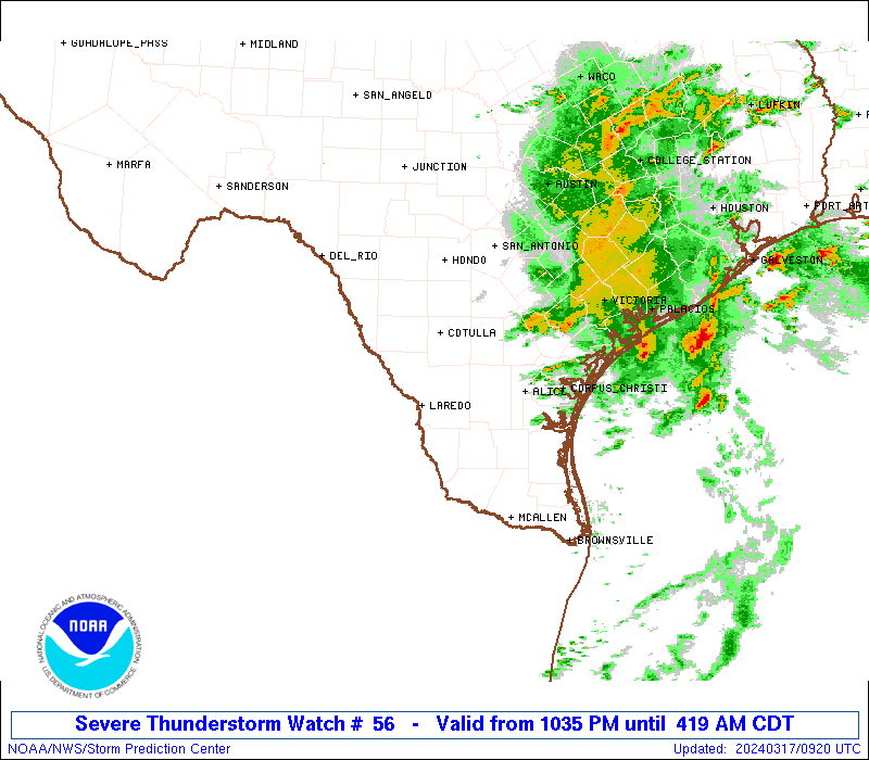
I'm wondering about the severe threat here Tuesday. 3k jumps out as a wind/hail threat to me

Sent from my SM-G955U using Tapatalk

Sent from my SM-G955U using Tapatalk

Tony,
We're approaching what I've found to be the most crucial factor to determine the chance for a hot summer in the Atlanta area (and probably much of the SE), May-June rainfall. If if the May-June period is wet enough, not only would June likely not be hot but July-August would also likely not be hot due to wet enough soils lasting long enough.
No was not progged SPC Day 1. A MSD was issued with "watch unlikely" but increase in both marginal instability plus increase low level shear has maintained some cells across the FLA Panhandle and SE AlabamaWas this expected?

Well, Larry this system over us now is as dynamic as I've had for a number of winters, lol. Cut off, closed upper low, strong cad, surface low coming, plenty of rain, lots and lots of wind. The last time I had winds and rain like this, hour after hour, was when the hurricane was coming by...like bookendsTony,
We're approaching what I've found to be the most crucial factor to determine the chance for a hot summer in the Atlanta area (and probably much of the SE), May-June rainfall. If if the May-June period is wet enough, not only would June likely not be hot but July-August would also likely not be hot due to wet enough soils lasting long enough.
It's incoming, Tony ... Duck ... and enjoy!Well, Larry this system over us now is as dynamic as I've had for a number of winters, lol. Cut off, closed upper low, strong cad, surface low coming, plenty of rain, lots and lots of wind. The last time I had winds and rain like this, hour after hour, was when the hurricane was coming by...like bookendsI am loving this system. This has been a great April...one of the best in a long, long time, to me. I would be nice if it portends a cool summer, and an early fall....and, a old fashioned, Long winter, lol. Tony
Oh, I'm ducking, Phil, lol. I have limbs down all over. They've been hitting the ground all day, and especially tonight. Constant gusts, and .8 in the bucket. If it was just a bit colder, this would be a great Jan or Feb storm, the kind of 38 and windy rain we used to see...back when winter was winter, not this wussie junk that passes for winter now, lol. April is kicking Feb.'s buttIt's incoming, Tony ... Duck ... and enjoy!
Stay cool!
Best.
Phil
Wind has been a lot more than I expect, with not as much rain. I lost power for about 2 hours because of the winds. crazy
I was just thinking this after seeing the latest rainfall projections for the next couple of days. I am beginning to think we are in for a cooler than normal summer possibly if we can keep the soils moist enough to not let us bake. Of course, the below normal pattern has also been around for a hot minute now.... what's the chances it continues on for another season? Or is there even any correlation to that?
As of this morning, we're just over 2" here and more to come later today.I only have 0.57" in the bank. Looks like I will be on the lower end of 2 or maybe a high 1 for this event. Models were showing more... but seem to have trended back on that as the event has unfolded. Anyone have any thoughts on evolution of the storm so far? Winds are definitely verifying on the higher side though for sure.
Regardless of what some often too wet models have shown, the ATL area has already received a generous ~1.5" of rainfall and it doesn't appear to be done yet per models. Totals near 2" are quite possible in that area. Even if not, 1.5" of widespread rainfall is pretty impressive vs most systems this time of year.
Gainesville, GA, has already reached 2.2". FFC called for 2-4" totals with heavier NE GA. I don't see them being too far off of this. Also, this is close to what the more reliable model consensus has been showing for the last few days from what I've seen. There's no telling when there will be another widespread generous rainfall event like this again as systems like this don't occur that often.
My area has received near 0.5"
& I'm thinking we end up with near 1"
total on average through this area, which would mean a very nice near 2.25" the last 10 days.
Edit: ForsythSnow has already received 2" per the above post.
Much of central GA has already received 1.25-1.5". However, Augusta has received a lot less.
